Beschreibung
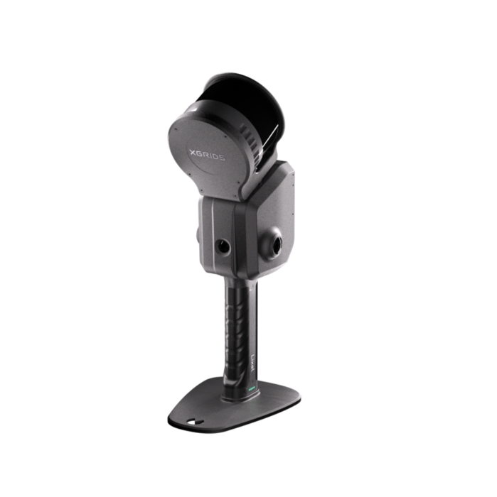
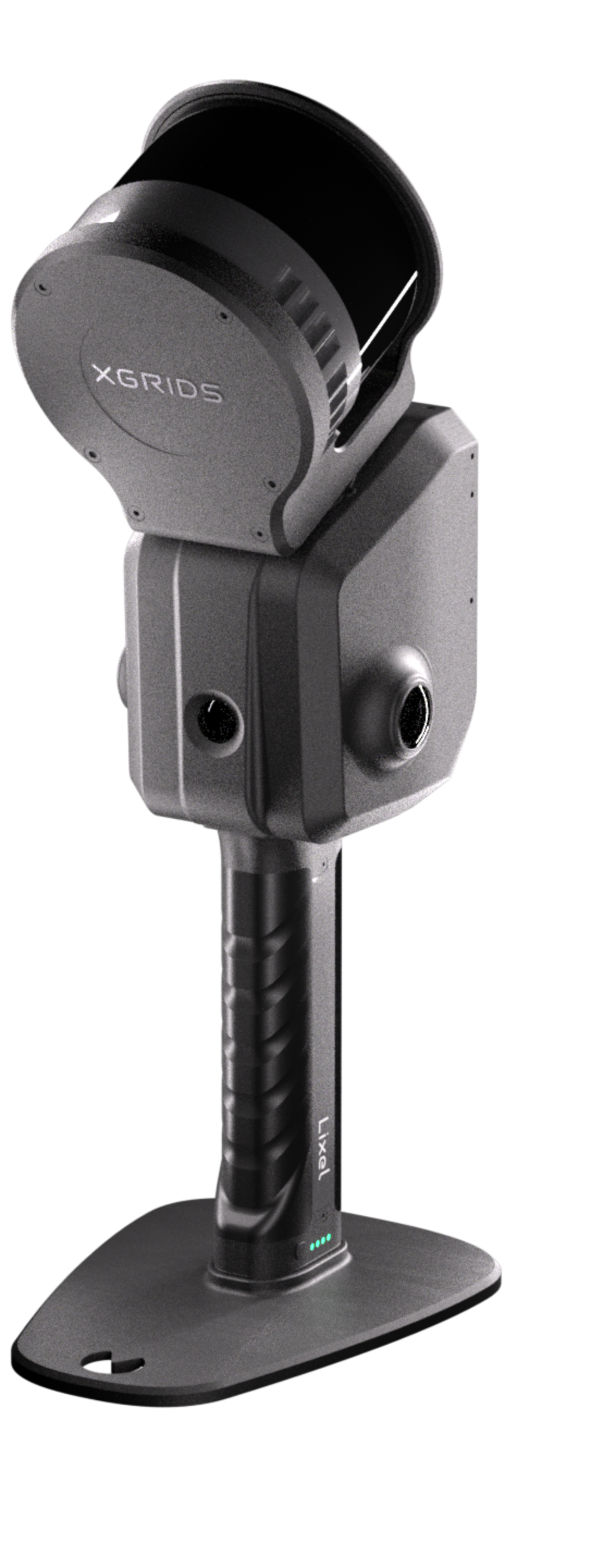
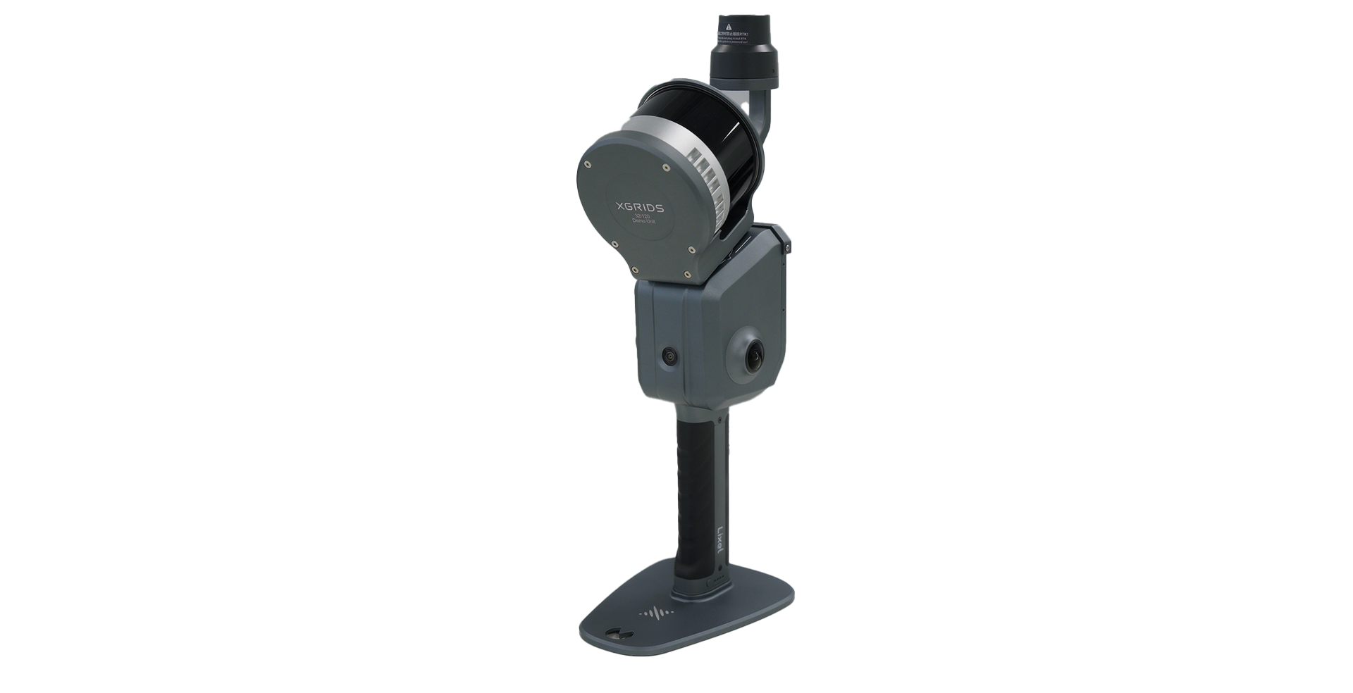
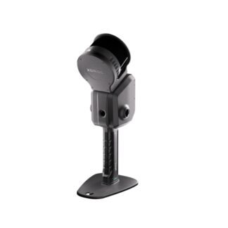
XGRIDS – Lixel L2 Pro/120m Standard Package (32 Channel)
L2 Pro – Next-Gen 3D Scanning Technology based on Multi-Slam & 3D Gaussian Splatting!
Der neue Lixel L2 Pro kombiniert LiDAR-, visuelle- und IMU-Positionierung (multi-Slam) mit KI und liefert hochauflösende Punktwolkendaten in Echtzeit. XGRIDS läutet mit dem L2 Pro damit das Zeitalter der „Null-Nachbearbeitung“ für SLAM-Geräte ein. Ein weiterer Vorteil: es fallen keine zusätzlichen Kosten für die lokale Prozessierung der Daten an (auch Offline möglich).
- 120 m Reichweite
- 640.000 Punkte / Sekunde
- 1mm Punktabstand
- 1cm relative Genauigkeit
- 3cm absolute Genauigkeit (Realtime)
- RTK Modul(e) verfügbar
- inklusive Lixel Studio (dauerhaft kostenfreie Lizenz inklusive Updates)
True SLAM with real-time Output
L2 Pro delivers real-time point cloud data that rivals the accuracy of L2’s post-processing, with no waiting—instantly ready for use.
The LixelUpSample™ algorithm: Generating photo-quality color point clouds
1 million points/㎡ with 1mm spacing for dense point clouds, capturing every detail with precision.
5mm point cloud thickness for more accurate mapping and line drawing.
Reliable SLAM for complex environments
Exclusive Multi-SLAM algorithm enhances adaptability and reliability in challenging environments:
Provides continuous absolute coordinates in satellite-signal-limited areas like indoors or underground.
Ensures stable mapping in degraded environments environments such as subways and tunnels
- Real-time data with absolute coordinates
- A seamless, user-friendly, and reliable workflow
- Maximize usability and flexibility with the accessories
LixelGO
The Lixel Companion App
Easy control with one screen, one-click operation. Full process operations such as RTK setting and breakpoint rescan. Real-time viewing of camera images, elevation information, and true-color point clouds to avoid missing or incorrect data collection. Complete display of collection status such as battery power, network, memory, and range.
Lixel Studio
All-in-One Point Cloud Processing Software
LixelStudio is a comprehensive 3D point cloud processing software powered by spatial intelligence algorithms. It offers tools for viewing, editing, and processing point cloud data, along with industry-specific plugins. With AI-enhanced capabilities, it boosts data processing efficiency and delivers breakthrough 3D data productivity.
One-Click Processing
Easily process point cloud data to improve precision and visual quality.
Panoramic Overlay
Panoramic overlay simplifies measurement and modeling.
Map Fusion
Combine multiple datasets for complete, large-scale point cloud data.
Advanced Editing Tools
Offers registration, noise removal, length and area measurement, 3D clipping and more.
Accuracy Report
Verifies point cloud accuracy manually or automatically and generates detailed reports.
_____________________________
Benutzerhandbuch deutsch
Fordern sie sich ein unverbindliches Angebot an: info(at)3ds-scan.de
Lieferumfang
Lieferumfang:
1x Handheld Scanner (32/120)
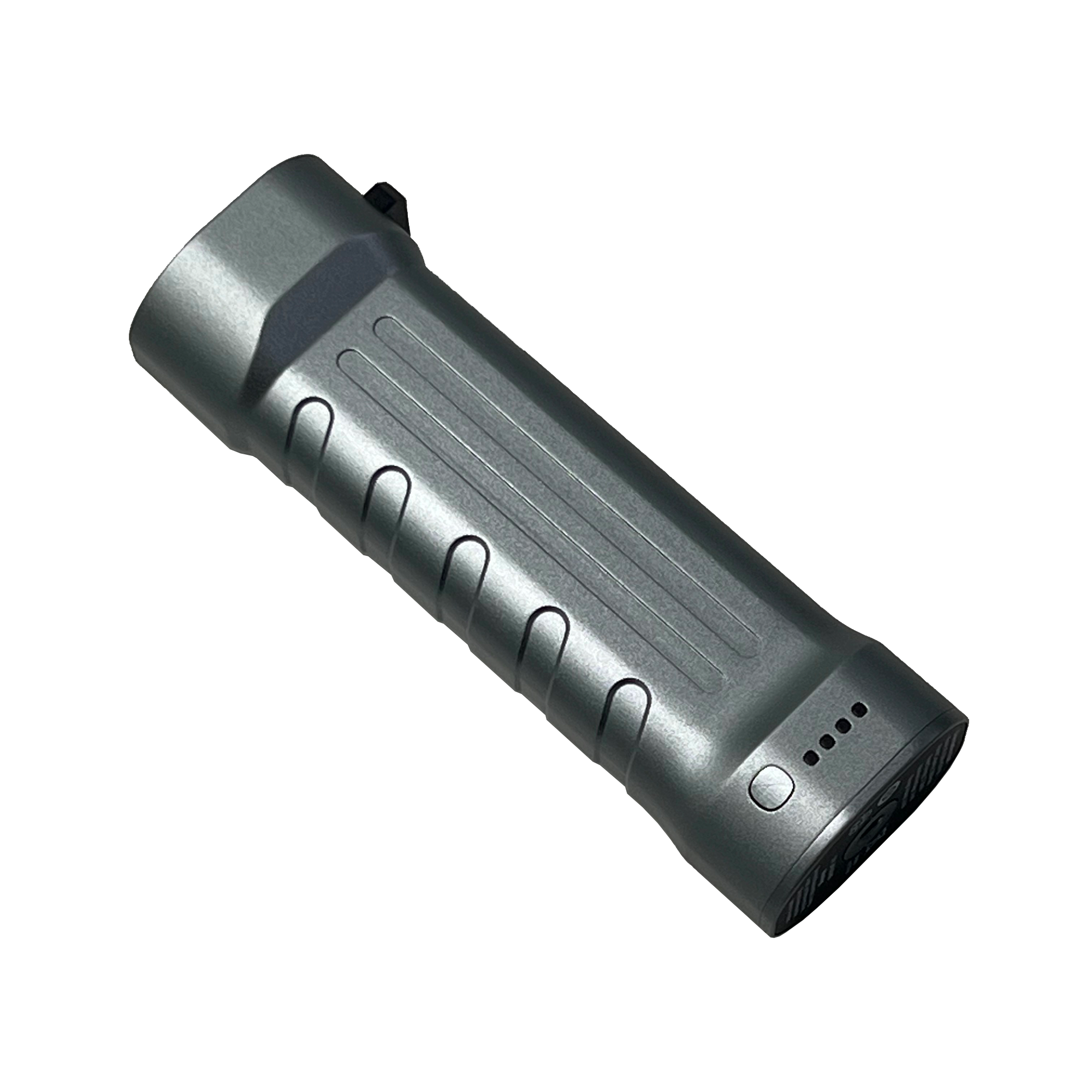
1x L2 Series Handle Battery
1x L2 Series Charger & Converter
1x Type C Cable
1x GCP Collection Plate
1x Quick Start Guide
1x Warranty Card
1x Cleaning Cloth
1x Protective Case
Technisches Datenblatt
System Parameters
Weight: 1.7kg
Size ı: 180mm X 130mm xX400mm
Outer Casing: Industrial-grade Aluminium
Interfaces: USB 3.1 Gen2
Storage: 1TB SSD
Continuous peration Time: 1.5h
Power Consumption <30W
Wireless Supports WiFi, Bluetooth :802.11a/b/g/n/ac, 2.4-2.4835 GHz and 5.15-5.85 GHz
Environment
Operating Temperature: -20°C-50°C / -4°F-122°F
IP Rating: IP54
Functions
Visual Positioning Supported
Real-time RTK Fusion Supported
Real-time RGB Supported
Output
Point Cloud Formats: .las .ply
Image Formats: .jpg
Real-time Accuracy
Absolute Vertical Accuracy (RMSE) [2]: 3cm
Relativet Accuracy (RMSE)[3]: 2cm
AbsoluteHorizontal Accuracy (RMSE)[2]: 3cm
Processed Accuracy
Absolute Vertical Accuracy (RMSE) [4]: 3cm
Point Cloud Thickness [5]: 0.5cm
Absolute Horizontal Accuracy [4] 3cm
Horizontality (with RTK) [6]: 0.015°
Relative Accuracy(RMSE) [3]: lcm
Verticality: 0.03°
Repeat Accuracy(RMSE) [5]: 2cm
LixelUpSample: Supported
LiDAR
Operating Range: 0.5m-120m (L2 Pro 32 channel 120 m)/ 0.5m-300m L2 Pro 32 channel 300 m)
Scanning Frequency: 320,000 points/s (16 channel) / 640,000 points/s (32 channel)
LiDAR Sensor: Class 1 / 905nm
Sensor FOV: 360°x 270°
Camera for Panoramic Images
Resolution: 2x48MP
CMOS: 1/2”
Focal Length: 2mm
Shutter: Rolling shutter
Aperture: F/2.0
FOV: 190°x 190°
Camera for Visual Positioning
Resolution: 1X1MP
FOV: 190°x 119°
Shutter: Global shutter
Battery
Voltage: 14.4V
Capacity: 46.8wh
Charging
Input: 100V-240V 50-60 HZ 1.5A 80VA
Power Rating: 34W
Output: 16.8V 2.0A
Accesorries and RTK
Backpack with Stabilizing Arm
Dimensions:60cm X 60CX 15cm
Weight: 2.5KG
Backpack with Padding
Dimensions: 55cm X 35cm X25cm
Weight: 2.7KG
Standard RTK [7]
Supported Channels:
GPS L1/L2/L5
GLONASS L1/L2
BDS B1/B2/B3
Galileo E1/E5a/E5b/E6b
Accuracy:
Horizontal: 0.8cm+1 ppm
Vertical: 1.5 cm+1l ppm
Survey Grade RTK [7]
Supported Channels:
GPS L1/L2/L5
GLONASS L1/L2
BDS B1/B2/B3
Galileo E1/E5a/E5b/E6b
Accuracy:
Horizontal: 0.8cm+1 ppm
Vertical: 1.5 cm+1l ppm
2m Extension Pole: Supported
Mobile Phone Mount: Supported
Control Point Plate: Supported
Shipping case
Dimension:
42cm*34cm*l8cm
Weight with System: 6.6kg
[1]Includes battery and base, excludes other accessories.
[2]RTK disconnection <100m.
[3]Distance between two points is less than 100m.
[4]GCP/RTK disconnection <100m.
[5]Two RTK-enabled scans without disconnection.
[6]Point cloud thickness within 10m of the walking path.
[7] The test results may be affected by atmospheric conditions, baseline length, GNSS
antenna type, multipath effects, the number of visible satellites, and satellite
geometry, which could cause deviations. The measurement was conducted using a
1km baseline and receivers with good antenna performance, without accounting for
potential antenna phase center offset errors.


Rezensionen
Es gibt noch keine Rezensionen.